What is a Carbonate Assessment?
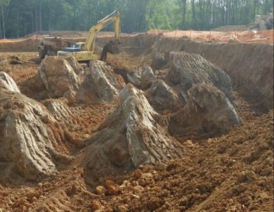
Example of Limestone Bedrock Pinnacles that have been exposed during excavation.
A carbonate assessment is part of the due diligence process that is prudent and also required by some municipalities to evaluate if a property is underlain by carbonate bedrock (karst). Areas underlain by karst geology are at risk for natural sinkhole formation. A carbonate assessment involves a site reconnaissance by a geologist and a review of published geologic information and to evaluate that risk for sinkhole development. The site reconnaissance evaluates physical features that may be indicative of active sinkhole conditions. Features such as outcrops of bedrock, caverns, closed depressions, sinkholes/open voids, intermittent ghost lakes, and ephemeral disappearing streams are investigated during the site reconnaissance. A report is provided that discusses the findings and the risk for sinkhole activity. A carbonate assessment may also include a fracture trace analysis, a geophysical survey and a subsurface investigation.
What is a Fracture Trace Analysis?
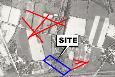
Example of a Fracture Trace Analysis
A fracture trace analysis is a method that is often used as part of a carbonate assessment. The fracture trace analysis consists of a review of a series of aerial photographs of the site. A stereoscopic viewer, which allows for a 3D view of the land, is used to interpret lineations on the ground surface. Where the lineations cross on the ground surface represents a higher risk for sinkhole formation. Reviewing stereoscopic aerial photographs of the subject property is conducted as part of the literature review commonly performed with a carbonate assessment. The fracture trace analysis can identify faults, fractures, joints and veins within the underlying bedrock. The overall intent is to identify directional trends of sinkhole alignment. Upon completion of the fracture trace analysis, a map showing the lineations detected is presented that is used for further inspection and interpretation of site features.
How is a Sinkhole Investigation Performed?
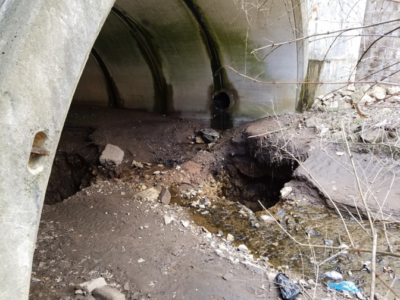
Disappearing stream due to sinkhole activity.
A sinkhole investigation is typically conducted after a Carbonate Assessment is performed when active sinkhole conditions are detected. The most common approach is to initially perform a geophysical survey. The geophysical survey is a non-invasive approach to investigate the subsurface conditions. Typical methods for a geophysical survey are Seismic Refraction, Electric Resistivity, Multi-Analysis of Surface Waves (MASW), and Microgravity. The intent of the geophysical survey is to identify anomalies in the subsurface that could be indicative of an incipient sinkhole. Upon completion of the geophysical survey, a subsurface investigation such as a test boring operation is typically performed to further evaluate the results of the geophysical survey. In addition to assessing the risk for sinkholes, information such as the depth to rock, soil densities and soil types are typically determined from the investigation. If active sinkhole conditions are encountered, recommendations for sinkhole mitigation and risk reduction are presented.
Earth Engineering conducts carbonate assessments, sinkhole investigations, and fracture trace analysis. Contact one us at either of our 4 locations to discuss your subsurface investigation needs and how Earth Engineering can help.
Follow Us